


AFTrack-Lite - GPS Tracking
AFTrack-Lite - GPS Tracking介绍
AFTrack is the display for your navigation and activates the world of hiking, biking, sailing, geocaching or more for your phone. The program handles tracking with smart and fixed logging features. If needed it sends reports online or via SMS, it receives SMS position messages and show it as a waypoint. It exports tracks and waypoints. Uses maps online and offline and more.
Features
GPS and other input
- different gps sources: internal gps, internal with NMEA, bluetooth gps direct, USB gps, online gps over Wifi/3G, NMEA file
- read NMEA, GpsD json, Signal K json
- work as gps daemon (nmea or json, port 2947 only)
- share position (replaces standard gps provider)
- connection with AIS server (NMEA format)
- altitude correction (automatic or manual) and Kalman filter
- pressure usable for altitude (if available)
- pressure start altitude editable
- automatic correction over weather server (needs net connection)
Tracking
- collect track data
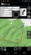
- show routes or tracks in up/down hill colors
- export tracks to GPX, KML, OVL, IGC format and send or upload it
- import route data - GPX, TCX or KML format
- import, export way points - GPX or KML format
- import areas from KML format
- use a kml.txt format to send exports direct via bluetooth
- design a route or an area on the map
- design a route using BRouter offline data, with Inland waterway
- design a route using wind information and polar data
- edit a route or an area on the map
- merge some routes
- copy way points to route
- get new way point from bearing, map or position
- add predefined way point collection to map
- revers routes
- Routing in a corridor
- off road routing along the line
Maps
- online maps - pool editable, tile or WMS based
- offline maps - OSZ format build by MobileAtlasCreator
- offline maps - SQLite formats mbtiles and sqlitedb build by MobileAtlasCreator and/or Maperitive
- offline maps - BSB3 format for marine navigation
- offline maps - NV digital for marine navigation
- offline maps - mapsforge vector format - with extra xml layouts usable (V4)
- offline maps - mph/mpr format
- use offline maps from jpg, png or bmp files
- use offline maps with calibration file map, gmi, kml, kal, cal, pwm, tfw or jpr format
- make own calibration for a bitmap
- seamless maps display when using OSZ or SQLite tile container
- map selector to have quick access to maps
- map scan for a defined folder and sub folder
- map overlays - online pool editable
- map offline overlays - in mbtiles 'overlay' format
- scaling charts 2x/4x
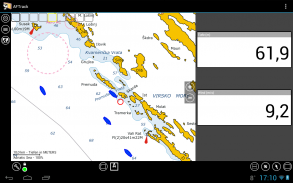
View
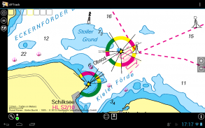
- wind indicator for the map or position center
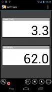
- display depth - if available
- display AIS information - if available
- display ADS-B (air plane) information - if available
- vario display
- vario sound
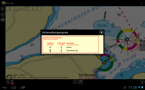
- alarm on reached POIs
- set anchor alarm for the current position
- set anchor alarm for a way point that receives positions from a gps tracker
- save and restore settings
- send waypoint or anchor alarm to Android Wear
Online
- Online position sending for live tracking
- Online receive way point positions from a GpsGate server
- works as SMS provider (needs a plugin)
- short message position sending
- short message position receiving
- short message from GPS tracker TK102, TK102-2, TK102 clones, TK-Star, DNT, ELRO, GEODOG, Benefon ESC, Benefon Trackkeeper NT, WondeProud spt10, Tracker from tracker.fi, Wo-ist-Lilly or SmartcomGps
- text storage for short messages e.g. for Xexun tracker
- set position from short message
- send sms note to other AFTrack instance and get position back
- collect short messages to a track, single and multi-tracking
- getting way point positions from a GpsGate server
Notice: the SMS features are removed by Google.
Please send remarks to afischer@dbserv.de
The lite version differences
- no automatic position sending
- no template sending via short message
- loads only three offline maps in automatic mode
- has a start screen
- has inside advertising
- limited export
- no multi track colors
AFTrack是您的导航显示器,可激活手机的远足,骑自行车,航行,寻宝或更多功能。该程序使用智能和固定日志记录功能处理跟踪。如果需要,它可以在线或通过SMS发送报告,它可以接收SMS位置消息并将其显示为航路点。它导出轨迹和航路点。在线和离线使用地图等等。
特征
GPS等输入
-不同的gps来源:内置gps,内置NMEA,蓝牙gps直接,USB gps,Wifi / 3G上的在线gps,NMEA文件
-读取NMEA,GpsD json,Signal K json
-用作gps守护程序(nmea或json,仅端口2947)
-分享位置(代替标准GPS提供商)
-与AIS服务器连接(NMEA格式)
-高度校正(自动或手动)和卡尔曼滤波器
-可用于海拔的压力(如果有)
-压力开始高度可编辑
-通过天气服务器自动校正(需要网络连接)
追踪
-收集轨道数据
-以上/下山色显示路线或路线
-将曲目导出为GPX,KML,OVL,IGC格式并发送或上传
-导入路线数据-GPX,TCX或KML格式
-导入,导出路标-GPX或KML格式
-从KML格式导入区域
-使用kml.txt格式直接通过蓝牙发送导出
-在地图上设计路线或区域
-使用BRouter离线数据和内陆水道设计路线
-使用风信息和极地数据设计路线
-在地图上编辑路线或区域
-合并一些路线
-复制路线点
-从方位,地图或位置获取新的航路点
-将预定义的航路点集合添加到地图
-逆转路线
-在走廊里走
-沿线的越野路线
地图
-在线地图-池可编辑,基于图块或WMS
-离线地图-MobileAtlasCreator构建的OSZ格式
-离线地图-由MobileAtlasCreator和/或Maperitive构建的SQLite格式mbtiles和sqlitedb
-离线地图-海洋导航的BSB3格式
-离线地图-用于航海的NV Digital
-离线地图-mapsforge矢量格式-具有可用的额外xml布局(V4)
-离线地图-mph / mpr格式
-使用jpg,png或bmp文件中的离线地图
-将离线地图与校准文件地图,gmi,kml,kal,cal,pwm,tfw或jpr格式一起使用
-对位图进行自己的校准
-使用OSZ或SQLite切片容器时无缝显示地图
-地图选择器可以快速访问地图
-扫描定义的文件夹和子文件夹
-地图叠加-在线泳池可编辑
-离线地图叠加层-mbtiles“叠加层”格式
-缩放图表2x / 4x
视图
-地图或位置中心的风向指示器
-显示深度-如果有的话
-显示AIS信息-如果有的话
-显示ADS-B(飞机)信息-如果有的话
-Vario显示
-Vario声音
-警报到达的POI
-将锚警报设置为当前位置
-为接收来自GPS追踪器位置的航路点设置锚定警报
-保存和还原设置
-将航点或锚点警报发送到Android Wear
线上
-在线职位发送实时跟踪
-从GpsGate服务器在线接收航路点位置
-用作SMS提供程序(需要插件)
-短信位置发送
-接收短信位置
-来自GPS追踪器TK102,TK102-2,TK102克隆,TK-Star,DNT,ELRO,GEODOG,Benefon ESC,Benefon Trackkeeper NT,WondeProud spt10,tracker.fi,Wo-ist-Lilly或SmartcomGps的跟踪器的短消息
-短消息的文本存储,例如适用于Xexun追踪器
-通过短信设置位置
-发送短信到其他AFTrack实例并重新获得位置
-收集短信跟踪,单轨和多轨
-从GpsGate服务器获取航路点位置
注意:短信功能已被Google删除。
请发送评论至afischer@dbserv.de
精简版版本差异
-没有自动发送位置
-没有模板通过短信发送
-在自动模式下仅加载三个离线地图
-有一个开始屏幕
-有内部广告
-出口有限
-没有多轨颜色
AFTrack-Lite - GPS Tracking - 版本1.12.10
(18-12-2021)AFTrack-Lite - GPS Tracking - APK信息
APK版本: 1.12.10程序包: de.afischer.aftrack.liteAFTrack-Lite - GPS Tracking的最新版本
其他版本


同类应用


